
By Lebone Rodah Mosima
A severe hailstorm accompanied by heavy rain and strong winds battered parts of eThekwini on Tuesday afternoon, causing localised flooding and disrupting traffic as emergency teams were placed on high alert across KwaZulu-Natal.
KZN MEC for Transport and Human Settlements Siboniso Duma said several areas of the metro had been affected.
ALSO READ: Solidarity takes Amazon to OECD over 100% black-owned business programme
“These severe weather patterns have been triggered by the cut-off low-pressure system,” he said.
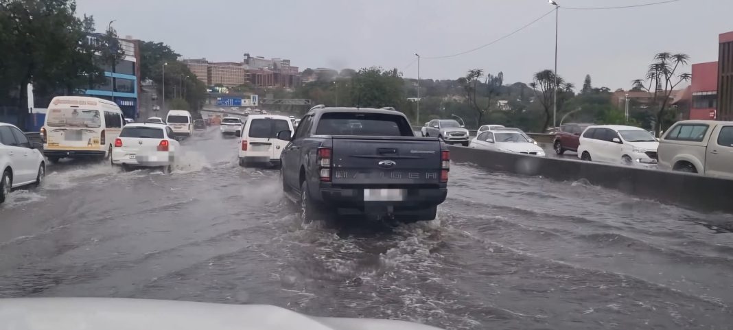
The eThekwini Municipality reported localised flooding on the N3 eastbound before the Tollgate Bridge after heavy downpours left parts of the freeway under water.
Three lanes were closed because of high water levels. “Emergency services and Metro Police are on site managing traffic flow,” the municipality said.
“Motorists travelling inbound towards the Durban CBD are strongly advised to use alternative routes, exercise extreme patience, and allow for travel delays.”
The municipality said severe thunderstorm activity remained active across parts of KwaZulu-Natal, including eThekwini, with further heavy downpours, frequent lightning, damaging winds and localised flooding possible during the remainder of Tuesday.
“Municipal emergency response teams remain on high alert and are actively monitoring low-lying areas, informal settlements, and major road networks prone to weather-related incidents,” it said.
“Members of the public are strictly advised not to cross swollen rivers, streams, or overflowing stormwater channels, on foot or in vehicles,” the municipality said.
“The city will continue to provide official updates as the weather develops.”
Duma said teams from the Department of Human Settlements were working with municipalities and other government departments to monitor high-risk communities and respond where necessary.
He said the Road Traffic Inspectorate (RTI) and Operation Shanela were also monitoring major routes, with roving teams deployed across the province.
ALSO READ: Suspended cop Fannie Nkosi asks DPP to rethink criminal charges
Duma said that Tuesday’s severe weather coincided with increased traffic and public movement associated with the middle-of-the-month payday.
“Being the payday, the 15th of September, we understand that there will be an increase in traffic volumes and movement of members of the public,” he said.
“Our highly efficient RTI team has been deployed in various strategic routes to monitor and directing traffic where necessary,” he said.
The KwaZulu-Natal Department of Cooperative Governance and Traditional Affairs (COGTA) has activated the Provincial Disaster Management Centre and placed municipalities across the province on high alert.
The South African Weather Service issued a Yellow Level 2 warning for severe thunderstorms over southern and eastern parts of KwaZulu-Natal, with storms expected from as early as 10am and continuing through the day.
“These thunderstorms could result in localised flooding, damage to infrastructure and settlements, as well as road accidents due to slippery roads and poor visibility,” KZN COGTA said.
The municipalities identified as potentially affected include Umuziwabantu, Ray Nkonyeni, Umzumbe, Umdoni, eThekwini, KwaDukuza, Mandeni, Richmond, Msunduzi, uMngeni, Dr Nkosazana Dlamini-Zuma, Maphumulo, Hluhluwe, Mthonjaneni, Ndwedwe, Mtubatuba, Nkandla, Ulundi, Nongoma, uMshwathi and Umzimkhulu.
KZN COGTA MEC Thulasizwe Buthelezi urged residents, particularly those living in low-lying areas and informal settlements, to take precautions and move to safer locations where necessary.
“Disaster management teams, working together with municipalities, will monitor the weather situation throughout the day to ensure the safety.”
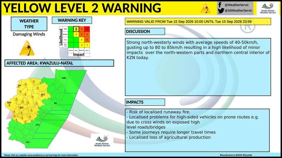
SAWS also warned of strong north-westerly winds in parts of KwaZulu-Natal.
“Strong north-westerly winds averaging 40-50km/h, gusting up to 80 to 85km/h, are likely to cause minor impacts in the north-western and northern central interior of KZN today,” SAWS said.
The winds could contribute to localised runaway fires, create difficulties for high-sided vehicles travelling on exposed routes and bridges, and increase travel times.
The weather service also warned of possible damage to infrastructure, informal settlements, property and vehicles, as well as risks to livelihoods and livestock.
Flooding could affect vulnerable roads, low-lying areas and bridges, while the storms could also lead to minor vehicle accidents and localised reductions in agricultural output.
The Yellow Level 2 severe thunderstorm warning extends to parts of Gauteng, the eastern Free State along the Lesotho border and northern North West.
Western Cape also under warning
In the Western Cape, SAWS issued a Yellow Level 1 warning as a cold front approaches from the south-west.
Strong to near-gale-force north-westerly winds of between 35km/h and 55km/h are expected, with gusts reaching between 60km/h and 75km/h.
The conditions could disrupt beachfront activities, make navigation difficult for small boats and cause damage to formal and informal structures.
High-sided vehicles travelling on exposed routes could also be affected by the strong winds.
INSIDE METROS