
By Lebone Rodah Mosima
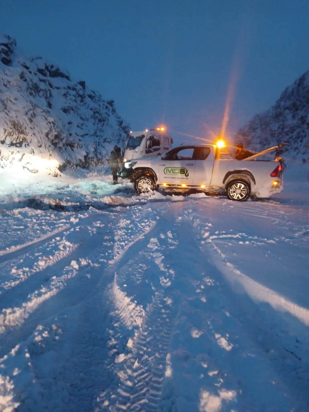
Heavy snow, freezing temperatures, rain and damaging winds continued to affect parts of South Africa on Tuesday, with an Orange Level 6 warning in place for parts of the Eastern Cape.
The South African Weather Service (SAWS) said disruptive snow could cause major traffic disruptions and temporarily cut off some communities in the province.
The warning applies to Emalahleni, Sakhisizwe, Senqu, Elundini and Matatiele municipalities.
ALSO READ: Madlanga slams Adams over late statement and ‘problematic laptop’
A Yellow Level 2 warning for disruptive snow was issued for other parts of the Eastern Cape, as well as eastern and southern parts of the Free State along the Lesotho border and western KwaZulu-Natal.
The Government Communication and Information System (GCIS) urged residents and motorists to remain vigilant.
In the Eastern Cape, snowfall had eased by Tuesday morning, allowing mountain passes that were previously closed to reopen, although roads remained wet and slippery.
The provincial Department of Transport said conditions were particularly difficult at Penhoek Pass on the N6 between Komani and James Calata.
“The Penhoek Pass on the N6 between Komani and James Calata is experiencing particularly thick fog and drizzle, resulting in poor visibility and less-than-ideal driving conditions,” the department said.
“Meanwhile, low-lying areas stretching to the coast continue to experience cold weather, steady rainfall and mist. Cautious driving remains the order of the day.”
The department said no major weather-related crashes were recorded overnight.
The GCIS also confirmed that the R58 between Lady Grey and Ekhephini had reopened after snow was cleared from affected sections.
In KwaZulu-Natal, Transport and Human Settlements MEC Siboniso Duma said Road Traffic Inspectorate teams and grader operators remained deployed to monitor major routes and areas vulnerable to further snowfall.
ALSO READ: Fadiel Adams testimony before Madlanga Commission likely to be postponed
“Once again, we request motorists to exercise extra caution as roads are wet and slippery. Please reduce speed and keep the following distance,” Duma said.
“Weather is overcast from Cedara towards Midway along the N3. It is drizzling from Harrismith towards Van Reenen.”
Duma said the N11 Amajuba Pass remained open in both directions, snow was clearing towards Memel and Bothas Pass to Memel was clear.
The GCIS said authorities were also monitoring the N3 and other routes linking KwaZulu-Natal and the Free State.
“In KwaZulu-Natal and the Free State, authorities are closely monitoring conditions along the N3 and other routes, including the Van Reenen and Oliviershoek Pass areas, where snow, sleet, rain, ice, and hazardous road conditions are affecting travel,” the GCIS said.
“The N3 between Harrismith and Van Reenen Pass should be approached with extreme caution. Emergency teams are spraying brine across all lanes to prevent black ice from forming.”
Gauteng was also feeling the effects of the cold weather system, with SAWS forecasting cloudy and cold to very cold conditions on Tuesday, accompanied by scattered showers and rain.
Conditions are expected to begin easing from Wednesday, with SAWS forecasting partly cloudy and generally cold to cool weather across much of the country on Wednesday and Thursday. Cloudier conditions and isolated to scattered showers and rain are, however, expected to persist in eastern areas.
SAWS issued a Yellow Level 2 warning for disruptive rain over much of Mpumalanga, excluding the far western parts of the province, with localised flooding possible in vulnerable settlements and along roads and bridges.
A Yellow Level 2 warning for damaging winds and waves was also in place along the KwaZulu-Natal coast, where conditions could affect small harbours, navigation and coastal activities.
Damaging wind warnings were issued for parts of the Western Cape and Northern Cape, including northern sections of the West Coast District, Witzenberg Municipality and parts of the Namakwa District, as well as western Mpumalanga.
SAWS also issued a Yellow Level 1 warning for damaging winds at sea between Table Bay and Cape Agulhas from Tuesday morning into Wednesday afternoon.
Extremely high fire danger conditions were forecast for the Richtersveld Municipality in the Northern Cape.
Very cold, wet and windy conditions were forecast across parts of the Free State, Northern Cape and Mpumalanga, as well as the interior of the Eastern Cape and KwaZulu-Natal, with further snow possible over high-lying and mountainous areas.
“Farmers and the general public are advised to take necessary precautions,” SAWS said.
The GCIS said the National Disaster Management Centre, provincial and local disaster management structures, traffic authorities and emergency services continued to coordinate responses in affected areas.
“Authorities are assessing road conditions, managing closures where necessary, and working to keep affected routes safe and accessible where conditions permit,” the GCIS said.
It urged motorists to obey road closures and check official weather and traffic updates before travelling, warning that conditions could change rapidly.
“Road closures are implemented to protect lives, and motorists should not attempt to bypass barriers or access roads that have been declared unsafe,” it said.
“Members of the public are urged to avoid sharing unverified information about road closures and weather conditions, as this may cause confusion and place motorists and communities at greater risk; as well as take precautions to protect children, older people, and other vulnerable people from extreme cold,” the GCIS said.
“Farmers and livestock owners are encouraged to ensure that livestock and other animals are kept in safe, warm, and adequately sheltered areas during periods of severe cold and snowfall.”
INSIDE METROS